↓
 

Gadsden Land Surveying

...a local Gadsden Land Surveyor.

Gadsden Land Surveying Header Image
Gadsden Land Surveying
  • Home
  • ALTA Survey
  • Boundary Surveying
  • Construction Survey
  • Drone LiDAR Mapping
  • Elevation Certificate
  • Land Surveying
  • Topographic Survey
  • Etowah County, AL
    • Gadsden, AL
    • Attalla, AL
    • Boaz, AL
    • Glencoe, AL
    • Hokes Bluff, AL
    • Rainbow City, AL
    • Southside, AL
  • Calhoun County, AL
    • Oxford, AL
    • Alexandria, AL
    • Anniston, AL
    • Jacksonville, AL
    • Ohatchee, AL
    • Piedmont, AL
    • Weaver, AL
    • Wellington, AL
  • St. Clair County, AL
    • Ashville, AL
    • Pell City, AL
    • Leeds, AL
    • Moody, AL
    • Odenville, AL
    • Ragland, AL
    • Riverside, AL
    • Steele, AL
    • Trussville, AL
  • Blog
  • Contact Us
Home - Page 3 << 1 2 3 4 5 6 7 >>

Post navigation

← Older posts
Newer posts →

How Important is Land Surveying in Today’s World?

Gadsden Land Surveying Posted on April 3, 2020 by Gadsden Land SurveyorApril 2, 2020
land surveying

Copyright (c) 123RF Stock Photos

Most of you have probably never thought about land surveying until you needed it at some point. Many of us hear about land surveying all the time but never really give it much thought. Since an investment in land and/or a home will likely be the largest investment you will ever make in your lifetime, knowing where your property lines are becomes very important indeed.

The art of land surveying was developed centuries ago. In fact, it’s one of the oldest professions in the world. The fact that it was used by man at such an early time and is still being used now shows how important surveying is to our survival.

The different uses of Land Surveying

Surveying land has many uses. Boundary surveying, for instance, allows you to know where your property corners or property lines are. This is especially helpful when disputes with a neighbour or with other people arise in terms of where your property ends.

If your family wants to divide a tract of land and transfer ownership to other family members, a boundary survey is the first step to do so. If you’re having a building constructed, it is very important that you have the land surveyed to make sure that you are not encroaching onto other peoples’ property. A mistaken building location is very expensive to fix so you might as well invest in a boundary survey to prevent this.

A topographic survey, or topo survey for short, is another important type of land surveying. A topo survey is done to locate natural and man-made features on a particular parcel of land. A topographic survey is different in that the elevation of the land is surveyed which means it can show man-made underground features, retaining walls, utility lines and etc.

Before you start any kind of construction activity, it’s important to have a topo survey done in the area so they’ll have an accurate record of the land’s existing conditions. Yes, that spot with the new mall in the neighbourhood had to have a topo survey done first.

Now, a flood survey or flood determination – this is very important too. It isn’t evident just looking at a property whether you are at risk of flooding or not. And, in some cases, even looking at the flood maps doesn’t give you an accurate answer. The flood survey determines the elevation of the home and compares that to the base flood elevation.

This is the only way to be sure you’re not in a flood hazard zone. If you’ve just been told that you live in a flood-prone area, having that confirmed by a professional land surveyor would let you know how to best proceed.
When getting flood insurance, insurance companies would require an elevation certificate from you. A land surveyor would be able to assist you with this.

If a company wants to invest in another state, or if there is a national lender on a commercial project, they will likely need an ALTA Land Title Survey done before anything is constructed. An ALTA Land Title Survey is a lot like a regular boundary survey except that nationally accepted ALTA Standards are used to guide the surveying effort.

Land surveying standards vary widely from state to state and an ALTA Land Title Survey is used to cut down on this variation. Also, an ALTA Land Title Survey typically is more involved than the state standards variety. Because of this, an ALTA survey can be more anywhere from 50% to 200% more expensive than using the state standards only. If you need this type of survey, I suggest seeking an experienced land surveying company who is familiar with these additional requirements.

In summary, there are many uses for a land survey and for seeking the services of a land surveyor. If you’re unsure of your situation, consult Gadsden Land Surveying at (256) 952-4711 today or go to the Contact page and send us an email.

Posted in alta survey, boundary surveying, construction, elevation certificate, land surveying, land surveyor, property survey, topographic survey | Tagged importance land surveying, Land Surveying, land surveying gadsden, land surveying gadsden al, land surveying importance

How To Find Your Home On FEMA’s Flood Insurance Rate Maps

Gadsden Land Surveying Posted on March 25, 2020 by Gadsden Land SurveyorApril 2, 2020

What are FEMA flood maps?

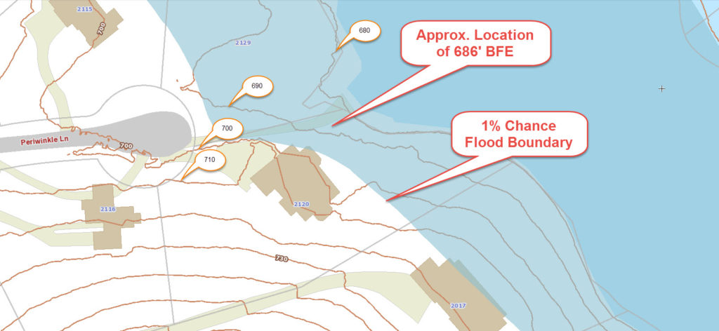
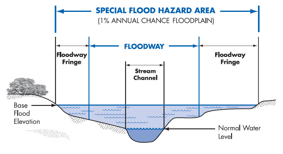
FEMA’s Flood Insurance Rate Maps (FIRMs) or just Flood Maps are provided after a flood risk assessment has been completed or updated for a community. This study is known as a Flood Insurance Study. The FIRM gives you the Base Flood Elevations (BFEs) and insurance risk zones in addition to floodplain boundaries. The FIRM may also show a delineation of the regulatory floodway.

Once the “flood hazard zone” (commonly referred to as the flood zone) is determined, actuarial rates, based on these risk zones, are then applied for newly constructed, substantially approved, and substantially damaged buildings. FEMA uses these rates to determine the insurance rate you will pay for flood insurance

FEMA’s Digital Flood Maps

FEMA discontinued the production and distribution of paper flood maps in 2009 as part of its Digital Vision Initiative. This affected all the Flood Maps, boundary information, and study reports. However, clients can still view the products for free through their website or buy them in digital format.

To view these flood maps online, go to FEMA’s Map Service Center and key in your address  to search for your home.  This will prompt you to then select the map that covers your area.  The Flood Maps are somewhat cumbersome to use online. It is best to go through the tutorial on the bottom right of the address search page for an easier and more effective use of the GIS map.

Call our land surveyors at (256) 952-4711 to discuss your the flood maps in your area or to have an elevation survey completed.

Posted in elevation certificate, flood damage, flood survey, land surveying, land surveyor | Tagged elevation certificate, FEMA flood map, flood maps, flood zone, National Flood Insurance Program

Surveying For Fence Contruction

Gadsden Land Surveying Posted on November 7, 2019 by Gadsden Land SurveyorApril 2, 2020

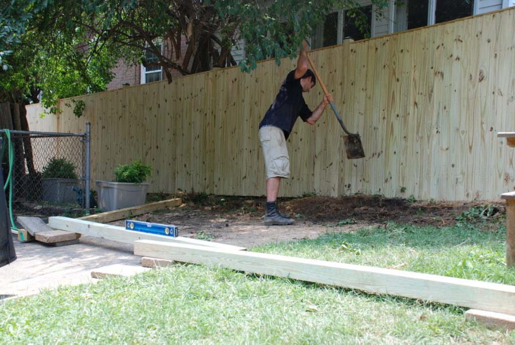
fence construction - fence lineIn a recent article “A lot on the line with a new fence,” the writer mentioned one of the sayings that I always think of regarding fences:

“Good Fences Make Good Neighbors”

Know Where Your Property Line is Located

A large portion of the calls I get are from homeowners wanting to know where their property line is to build a fence, or check whether their neighbor’s fence, or other improvement, is over the line. Knowing where your property lines are on your property is one of the most important things to know when planning for a fence.

While most fence contractors will require you to have a surveyor come out and mark the property lines before they start, some contractors will try to do this themselves. Skipping this step can cost you more than the fence cost. Even though the article writer (no name given) said that “hopefully, you won’t have to hire a surveyor” you should heed my advice on this one, get a surveyor to find and mark your corners.

Fences Usually Cost More Than a Survey

The writer also said that “a full survey could cost more than the fence.” From my experience, a fence can run anywhere from $10/linear foot for chainlink, to $20/linear foot for a wood privacy fence, or higher for more elaborate or ornate fences. Most lot line surveys, for less than an acre lot, will run anywhere from $400 to $600. In my area, I see them normally at about $500 max if the pins are still in. You’d have to have a pretty short cheap fence to cost less than a survey. AND, who wants to move the fence when you find the corners your contractor marked are wrong.

Surveying Cost Savings

If you want to save some money, do the research for the surveyor before you call to get a price. You should get a copy of your deed, scan it to PDF of take a legible photo of it. And, if you live in a subdivision, get a copy of the subdivision plat that is recorded in the Probate Office. Sometimes you can get the Probate office to email this to you. You should send all of your research to the surveyor.

I want to add that a “good fence” is built along the property line. THAT will make good neighbors. Sometimes it has to be 14 feet high, barbed and electric. If you need to know where your property lines are located for a fence or for any reason, call a land surveyor.
To talk about a fence survey for your fence construction job, call Gadsden Land Surveying at (256) 952-4711 today.

Posted in boundary surveying, construction survey, lot survey, property survey | Tagged boundary surveying, construction survey, fence construction, fence survey

Post navigation

← Older posts
Newer posts →

Search This Site

Get Quote Button
© Boxer Survey USA
3331 Rainbow Drive, Suite E, #151
Rainbow City, Alabama 35906
Phone: (256) 952-4711

Web Development and SEO by:
AuburnBusiness.com, LLC


Privacy Policy | Terms of Use

The owner of this website, Boxer Survey USA, provides coordination of professional land surveying and engineering services in all 50 states. The professional surveying and engineering services provided to you will be conducted by fully licensed professionals in your state.

↑