↓
 

Gadsden Land Surveying

...a local Gadsden Land Surveyor.

Gadsden Land Surveying Header Image
Gadsden Land Surveying
  • Home
  • ALTA Survey
  • Boundary Surveying
  • Construction Survey
  • Drone LiDAR Mapping
  • Elevation Certificate
  • Land Surveying
  • Topographic Survey
  • Etowah County, AL
    • Gadsden, AL
    • Attalla, AL
    • Boaz, AL
    • Glencoe, AL
    • Hokes Bluff, AL
    • Rainbow City, AL
    • Southside, AL
  • Calhoun County, AL
    • Oxford, AL
    • Alexandria, AL
    • Anniston, AL
    • Jacksonville, AL
    • Ohatchee, AL
    • Piedmont, AL
    • Weaver, AL
    • Wellington, AL
  • St. Clair County, AL
    • Ashville, AL
    • Pell City, AL
    • Leeds, AL
    • Moody, AL
    • Odenville, AL
    • Ragland, AL
    • Riverside, AL
    • Steele, AL
    • Trussville, AL
  • Blog
  • Contact Us
Home - Page 6 << 1 2 … 4 5 6 7 >>

Post navigation

← Older posts
Newer posts →

What You Need to Know About Land Surveying

Gadsden Land Surveying Posted on July 7, 2018 by Gadsden Land SurveyorApril 2, 2020

What is Land Surveying?


Land surveying is the art and science of accurately measuring parcels of land. Measurements such as dimensions, lengths, boundary lines, including structures within the area are all precisely determined through a land survey.

These measurements are used to establish land maps, boundaries for ownership or for governmental purposes. It is a detailed study of every physical and cultural property of the land, whether above or beneath it, to illustrate it in usable form.

Data is gathered through observations, research, field measurements, and data analysis for establishing property boundaries. Records from previous surveys and government records will strengthen the reports made after the survey.

What covers land surveying?

A land survey is classified according to the purpose or why the survey is being performed. Some of the common types of land survey are boundary surveys, topographic surveys, partition or subdivision surveys, flood elevation survey, property line adjustment survey, and extended title insurance coverage survey.

Other services such as mapping, construction layout surveys, judicial surveys, registered land surveys are all part of land surveying. It is an essential element in every development of the environment especially in the fields of construction, transport, communication, mapping, and most especially in the definition of legal boundaries for ownership.

The key component in the field of land surveying is the land surveyor. A land surveyor is a person that takes charge of every activity that transpires during a land survey.

It is the surveyor who makes the research and data gathering and even interpretation and analysis of all data wherein translation of all data gathered is crucial and should be checked, attested, and sworn in the law to be true and correct.

It is important then for you to choose a land surveyor with the highest degree of expertise and who can assume responsibility for the complex tasks at hand. It should be emphasized that only a surveyor who has knowledge of the elements of geometry, trigonometry, engineering, mathematics, physics, and the law are expected to have the best land survey outcomes.

Land surveying – dated back in history

Land surveying is a profession as old as the Egyptian times yet its importance to the human race still lives on. It is the best method to settle disputes over land ownership, it gives a clear picture of what buildings are suited to be constructed in a given land area, and it’s a convenient way to determine the exact dimensions of real estate to be purchased or sold.

Optimum potential of the land you own can only be defined once you have a land survey. Whether you are planning to put it on the market, or should you want to use it for commercial purposes, a land survey must back you up if ever questions regarding everything about the land arise.

Land surveying will provide a sense of security and peace of mind to every land owner and even to the future buyers.

Land surveying will always be an integral part in protecting real estate and upholding of laws governing the utilization and distribution of your land assets.


Posted in boundary surveying, land surveying, land surveyor, lot survey, property survey | Tagged land surveying gadsden, land surveying gadsden al, land surveyor, land surveyor gadsden

Land Surveying: Estimating the Cost

Gadsden Land Surveying Posted on June 2, 2018 by Gadsden Land SurveyorApril 2, 2020
land surveying

Copyright (c) 123RF Stock Photos

Land surveying, in short, is the science and art of establishing or re-establishing property corners, property lines and/or boundaries. There are different reasons why someone wants a lot surveyed.

Essentially the most common is to check if a piece of land is vulnerable to flooding, to subdivide a property to sell or deed to family members as well as to determine if there are any encroachments. This may happen if a neighbour disputes that you are using a piece of his lot or viceversa (for more on this, go here).

The Cost of Land Surveying

If you need to have a piece of land surveyed, the first thing that will come to mind is “how much will it cost?”There are plenty of factors determining exactly how much land surveying for your land would cost.

The fact that this type of service must be carried out by an expert contributes a great deal to the overall cost of the service, but choosing a non-professional to survey your land is dangerous and possibly illegal for the non-professional. Because of this you have to take a good look around before settling with a surveying company.

If you must work within a particular budget, discuss this with the surveyor up-front. Very often he may be able to offer cost saving steps to get the work you need done within these cost limits. The form of the land must also be looked into. A square or even a rectangle piece of land is somewhat easier to survey than an odd shaped parcel, or one with many different sides.

With the latter, the surveyor would have to take more time in surveying the curves as well as the bends which means the cost of the service would go higher.

The overall measurements the land is also key factor here. Understand that the cost of land surveying is normally proportionate to the time and effort that the land surveyor would spend on the project. If the land that you’re having surveyed isn’t accessible, or has thick vegetation, then the total price of the survey might go higher.

This is true of the varying weather conditions that might impact the work. Surveying in warm weather is somewhat slower to keep from putting the crew members in danger. Also, most surveying can’t be done in the rain.

When requesting for an estimate, bear in mind that surveyors base the estimate on expected conditions at the site. These conditions could change, bringing about additional costs. Always ask about these potential additional cost scenarios.

All that being said, competitive prices are also to be expected, this is why we recommend deciding on a surveyor based upon his experience and reputation rather than on the price he writes on a piece of paper. Usually it is better to invest a good amount of money on a survey that’s well-done rather than choose a company with a very “affordable” price but have the survey repeated because the results were wrong.

To sum it up, you should always discuss the expenses of the survey before you decide to ask the surveyor to start his work. It’s also wise to receive a contract that lets you know what is expected of the land surveyor. This is one of the most important steps in getting your land surveyed.

For a free land surveying quote, call us at (888) 936-8426 or send us a message by going here.

Posted in land surveying, land surveyor, property survey | Tagged cost land surveying, cost land surveying gadsden, estimation land surveying, land surveying cost, land surveying estimation

Can Engineering Flood Study Help Your Neighborhood?

Can an Engineering Flood Study Help Your Neighborhood?
flood zone | flood surveyA recent article in the Allied News in Grove City, Pennsylvania reminded me of the Engineering Flood Studies that I have completed over the years and how these have helped the neighborhoods adjacent to the streams that were studied.

“FEMA says it does allow the municipalities to pay for their own engineering study to prove that areas along Wolf Creek are no longer affected by flooding since dams were taken out.”

Not only are flood studies useful when conditions change, like a dam being taken out, but for the following conditions:

  • A stream has never had a detailed flood study completed (called Zone “A”)
  • Contemplation of widening a ditch to handle the flood waters within it
  • Proving that a stream Base Flood Elevation (BFE) and flood hazard zone are incorrectly shown

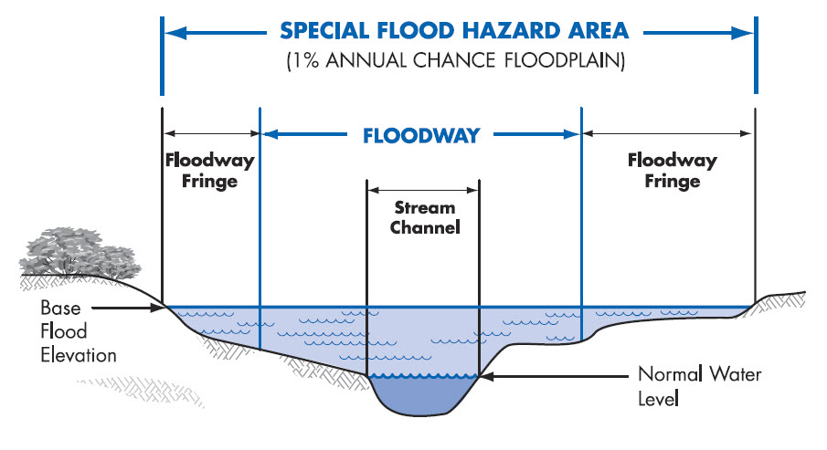
Every Stream Has a Base Flood Elevation

The fact about flood zones that most people don’t realize is that EVERY stream has an elevation that it will rise to given a certain amount of rainfall. The more rainfall, the higher flood waters will rise. So, when an area receives the 1% chance storm (formerly called the 100-year storm), you will see the flood waters rise to a level called the Base Flood Elevation (BFE). And, again, every stream has a Base Flood Elevation.

So, if you live by a dry ditch, an intermittent stream, or a year-round flowing creek, you should be aware of the Base Flood Elevation of that stream. So, FEMA doesn’t “PUT” you in a flood zone. They only map the flood hazard of more and more streams each time, and “SHOW” you in the flood zone that you were already in. There are also instances where development has occurred since the previous flood maps were created and your area has experienced an increase in the flood elevation because of the change in the amount and speed of the runoff.

Estimated Flood Zone “A”

The most common areas that are in need of a flood study are those estimated flood zone “A” areas on the flood maps. This means that a “detailed study” hasn’t been done for that area and the flood zone is estimated based on contour maps of the area. It is difficult for insurance companies and surveyors to determine your risk in these areas because we don’t have an elevation to use to compare to your home elevation.

The steps for an Engineered Flood Study are:

  1. Determine the length of the stream to study. This can be 500 to 5000 feet or more.
  2. Collect cross-sections of the stream. This gives the shape of the stream bed which tells us how much water can move through the stream and how far outside the banks the flood water will come.
  3. Determine the drainage area for the stream. This is done using contour maps of the area.
  4. Estimate the runoff coefficients for the drainage basin. This is not easy to accurately estimate and this step is where lots of variance is built into the equations.
  5. Use the data collected and an approved method and software program to determine the base flood elevation.
  6. Submit the findings to FEMA for concurrence and approval.

As I said in one of the steps, drainage calculations are only estimates. All of the approved methods and formula have a certain amount of variance in them. Most methods are from 65% to 85% accurate. This is based on the many types of soil, vegetation, and ground cover that occurs within the drainage basin, and the estimates used in the amount of rainfall and runoff that occurs.
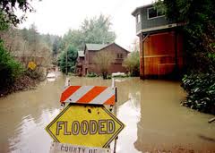
flood survey | flood study | flood zoneThis is why most flood ordinances require that new homes are built at least one to two feet above the BFE. And, it’s the reason that I always recommend that you get flood insurance if you are close to a stream, even if you are shown as being OUT of the flood hazard zone. The insurance policy is cheapest in that situation. And, flooding over the 1% storm happens all the time. Consider it similar to your homeowners insurance which covers fire damage.

References: Trends in Floods,  and The Human Impact of Floods
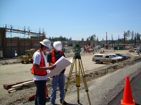
If you have questions about a flood study, or any other flood elevation questions, call Gadsden Land Surveying at (256) 952-4711.

Posted on September 25, 2017 by Gadsden Land SurveyorApril 2, 2020

Post navigation

← Older posts
Newer posts →

Search This Site

Get Quote Button
© Boxer Survey USA
3331 Rainbow Drive, Suite E, #151
Rainbow City, Alabama 35906
Phone: (256) 952-4711

Web Development and SEO by:
AuburnBusiness.com, LLC


Privacy Policy | Terms of Use

The owner of this website, Boxer Survey USA, provides coordination of professional land surveying and engineering services in all 50 states. The professional surveying and engineering services provided to you will be conducted by fully licensed professionals in your state.

↑