↓
 

Gadsden Land Surveying

...a local Gadsden Land Surveyor.

Gadsden Land Surveying Header Image
Gadsden Land Surveying
  • Home
  • ALTA Survey
  • Boundary Surveying
  • Construction Survey
  • Drone LiDAR Mapping
  • Elevation Certificate
  • Land Surveying
  • Topographic Survey
  • Etowah County, AL
    • Gadsden, AL
    • Attalla, AL
    • Boaz, AL
    • Glencoe, AL
    • Hokes Bluff, AL
    • Rainbow City, AL
    • Southside, AL
  • Calhoun County, AL
    • Oxford, AL
    • Alexandria, AL
    • Anniston, AL
    • Jacksonville, AL
    • Ohatchee, AL
    • Piedmont, AL
    • Weaver, AL
    • Wellington, AL
  • St. Clair County, AL
    • Ashville, AL
    • Pell City, AL
    • Leeds, AL
    • Moody, AL
    • Odenville, AL
    • Ragland, AL
    • Riverside, AL
    • Steele, AL
    • Trussville, AL
  • Blog
  • Contact Us
Home 1 2 3 … 7 8 >>

Post navigation

← Older posts

Welcome to Gadsden Land Surveying

Gadsden Land Surveying Posted on February 18, 2017 by Gadsden Land SurveyorApril 2, 2020

This site is intended to provide you with information on Land Surveying in the Gadsden, AL and Etowah County area of Alabama. If you’re looking for a Gadsden Land Surveyor, you’ve come to the right place. If you’d rather talk to someone about your land surveying needs, please call our local number at (256) 952-4711 today. For more information, please continue to read.

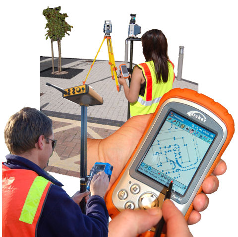
gadsden land surveyingLand Surveyors are professionals who make precise measurements to determine the size and boundaries of a piece of real estate.  While this is a simplistic definition, boundary surveying is one of the most common types of surveying related to home and land owners. If you fall into the following categories, please click on the appropriate link for more information on that subject:

Gadsden Land Surveying services:

    1. I need to know where my property corners or property lines are. (Boundary Survey)
    2. I have a loan closing or re-finance coming up on my home in a subdivision. (Lot Survey)
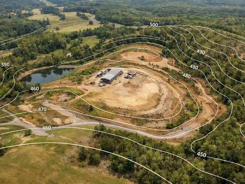
    3. I need a map of my property with contour lines to show elevation differences for my architect or engineer. (Topo Survey)
    4. I’ve just been told I’m in a flood zone or I’ve been told I need an elevation certificate in order to obtain flood insurance or prove I don’t need it. (Flood Survey)
    5. I’m purchasing a lot/house in a recorded subdivision. (Lot Survey – See Boundary Survey)
    6. I’m purchasing a larger tract of land, acreage, that hasn’t been subdivided in the past. (Boundary Survey)

Contact us for Gadsden Land Surveying services TODAY at (256) 952-4711.

Posted in alta survey, boundary surveying, elevation certificate, flood survey, land surveying, land surveyor, lot survey, property survey, topographic survey | Tagged Gadsden AL Land Surveyor, Gadsden Land Surveying, land surveyor

Planning a Detached Garage? Start With a Property Line Survey

Gadsden Land Surveying Posted on September 7, 2026 by Gadsden Land SurveyorSeptember 2, 2026
Detached residential garage and driveway in Gadsden Alabama for property line survey planning.

A property line survey is the first step for anyone planning a detached garage in Gadsden. Before you pour a foundation, you need to know where your lot ends. You also need to know where the city’s rules begin. 

A garage that looks fine on paper can still land in the wrong spot. This happens when the lot lines are wrong or unclear. This article shows how a property line survey helps at every step of planning a detached garage. That includes picking the right spot and getting your permit approved.

Check Garage Setback Requirements Before Choosing the Build Spot

Gadsden has rules for structures like detached garages. These rules come from the city’s zoning ordinance. Your garage can’t just go anywhere on your lot. It must sit a certain distance from your property lines. That distance depends on your zoning district.

This is where a property line survey helps the most. Once you know your exact boundaries, you can measure your planned garage spot against the required setback. Guessing at your lot lines is risky. So is trusting an old fence as your true boundary. Either one can put your garage too close to land that isn’t yours. A survey gives you real numbers, not guesses.

Do this early. Many homeowners pick a build spot first and check setbacks later. That order often leads to a redesign.

Fit the Detached Garage Into the Usable Part of the Lot

Every lot has some space you can build on. This space is usually smaller than most homeowners think. Start with your full lot size. Then subtract the required distance from each property line. Also subtract the space your house already takes up. What’s left is your real building area.

A property line survey shows this space clearly. You’ll see how much room you truly have for a garage once setbacks and other structures are counted. This matters even more on small or oddly shaped lots. A garage that seems to fit on a quick sketch might not fit once the real numbers come in.

Think of the survey as your starting map. It shows where you can build. It doesn’t just show where you’d like to build.

Account for Driveway Access Before Finalizing Garage Placement

A garage needs a way in. That sounds simple, but it trips people up. Many homeowners pick a garage spot first and plan the driveway later. Then they find out the path from the street doesn’t work well with the land.

Use your survey to plan the route from the street to the garage before you pick a final spot. A short, straight driveway usually costs less to build. It’s also easier to use than one that has to bend around obstacles. Checking this early can save you money on grading and paving later.

Garage placement and driveway placement go hand in hand. Choosing one without thinking about the other often leads to a layout nobody really wanted.

Use Survey Information When Preparing the Garage Site Plan

The Building Department handles building permits and zoning checks. Most permit applications need a site plan. This is a drawing that shows your garage next to your house, driveway, and property lines.

Survey information gives you accurate numbers for that drawing. Instead of guessing distances by eye, you can show exact measurements between the garage, the house, and each boundary line. A site plan built on real survey data tends to move through the permit process faster. There’s less back and forth, since the reviewer isn’t left guessing at the numbers.

Bring your survey to whoever draws up your site plan. That might be a designer, a contractor, or you, if you’re filling out the forms yourself.

Verify the Garage Location Before Construction Becomes Expensive to Change

Once digging starts, changing your plan gets expensive fast. Foundation work and poured concrete are hard to undo. If a problem shows up after the concrete is down, you’re facing a costly fix. In some cases, part of the structure may need to come down.

Check your garage location against your surveyed property lines before construction starts. This simple step can save you a lot of trouble. Walk the site with your survey markers in hand. Look at the planned corners of the garage one more time. Compare them to the required setback lines. This takes far less time than fixing a mistake after the crew has already broken ground.

This check is quick. But it’s the kind of step that pays for itself the moment it catches a problem.

Frequently Asked Questions

How close can a detached garage be to a property line in Gadsden? 

The required setback depends on your property’s zoning class and the rules tied to it. Setback rules can change from one district to the next. Always confirm the current rules for your lot before you build.

Do I need a property line survey before building a detached garage? 

A survey gives you clear lot line information. You can use it to plan your garage spot and check it against setback rules. Without a survey, you’re working from guesswork, and that can lead to costly mistakes.

Should the garage location be chosen before or after the survey? 

It’s better to get accurate property information first. Once you know your true lot lines, you can look at possible garage spots using real numbers. This beats changing your plan after the fact.

Posted in boundary surveying | Tagged boundary surveying

Boundary Survey Issues That Can Affect Riverfront Redevelopment Parcels

Gadsden Land Surveying Posted on August 21, 2026 by Gadsden Land SurveyorAugust 16, 2026
Boundary Survey crew measuring a riverfront redevelopment property in Gadsden Alabama

A boundary survey carries extra weight on riverfront property in Gadsden, Alabama. Older deeds and decades of building along the water can leave the recorded lines looking off. They may look very different from what a buyer assumes. Redevelopment parcels along a river often have a longer, messier history than a normal inland lot. That history has a way of surfacing right when a new project starts. It pays to check early.

Riverfront Boundaries Often Have a Complicated History

Older deeds along a river were often written before modern survey standards existed. Decades of building can leave gaps between what is recorded and what is really there. Public interests nearby, changing parcel shapes, and old construction all add layers to the record.

A boundary survey works through that layered history. It compares older papers against current field evidence. Then it builds a clear picture of where the line falls today. Skip this step on a riverfront parcel, and you take on more risk than you would on a plain inland lot.

Where Does the Boundary Sit Near Existing Improvements?

Walls, walkways, parking areas, and other features near the water often sit close to the line, sometimes closer than anyone expected. A boundary survey shows exactly how these features relate to the recorded line. It does not lean on guesses based on how the site looks today.

This matters most for redevelopment projects. New plans depend on knowing how much usable space sits between the boundary and the water. A few feet in either direction can change what the site can hold, which is why precise numbers help so much here.

Public Access and Private Limits Need Separate Review

Visible waterfront use is not the same as private ownership. People may walk a stretch of riverfront all the time. That does not mean the stretch falls inside the private parcel. The reverse can be true too.

A boundary survey keeps these two questions apart. It maps the private parcel limits. It does not assume that public use patterns define legal ownership. That split protects redevelopment plans and keeps them from being built around a mistaken idea. Knowing where private land really ends is a big deal.

Can Old Redevelopment Change the Boundary Evidence Found Today?

Yes, and this is one of the more overlooked risks. Demolition, grading, and utility work from old projects can remove or disturb the physical markers that once showed the boundary. That leaves a surveyor with less direct evidence to work from.

When that happens, the survey leans more on recorded numbers and nearby evidence. 

Here are a few common causes of disturbed boundary evidence on riverfront sites:

  • Demolition of older structures near the property line
  • Grading or fill work that buries original markers
  • Utility replacement that disturbs the ground near corners
  • Erosion or flooding that shifts visible ground features

Know these causes ahead of time, and you set fair expectations for how much fieldwork the job may take.

Resolving Boundary Questions Before the Layout Advances

An unclear parcel shape is a costly thing to find late. It hurts most after a design team has already set building footprints. Resolve boundary questions early, and designers get a stable base with no moving target in the process.

This is even more true on riverfront redevelopment. Space is often tighter there, so every foot of usable land matters more than it would on a larger inland site. Settle the boundary first, and the whole project stands on firmer ground.

Frequently Asked Questions

Can a survey find improvements built close to a riverfront line? 

Yes. This is one of the most common findings on riverfront sites. A boundary survey shows exactly how close walls, walkways, or other structures sit to the recorded line. This helps teams understand whether existing features need to be addressed before new construction can go forward.

What happens when older boundary markers have disappeared? 

The surveyor uses recorded numbers, nearby property evidence, and other proven methods to reset the line. This takes more time than a simple resurvey with markers still in place. It is still a reliable way to restore accurate boundary facts, even without the original physical markers.

Should adjoining riverfront parcels be surveyed together? 

Often yes, especially when a project spans more than one parcel. Surveying them together improves consistency and cuts the chance of conflicting boundary facts between adjoining tracts. This approach is common for larger riverfront projects that pull several older parcels into one site.

Can recorded public access affect how a survey is prepared? 

Yes. Recorded public access areas need to be found and kept separate from private parcel limits during the survey. This keeps the two types of rights from being confused. Clear notes on both protect redevelopment plans from later disputes over usable space.

How long does a riverfront boundary survey usually take? 

Timing depends on how much of the original evidence has survived and how complex the deed history is. A site with intact markers and clean records can move faster than one where the surveyor has to piece together decades of changes. Asking for a rough timeline early helps with project planning.

Posted in boundary surveying | Tagged boundary surveying

One Riverfront Project, Multiple Contractors, and the Need for Shared Survey Control

Gadsden Land Surveying Posted on July 16, 2026 by Gadsden Land SurveyorJuly 16, 2026
Survey crew using a total station while multiple contractors work on utilities, concrete, and grading beside a riverfront site.

A big riverfront job is really many jobs stacked on one site, and a construction survey keeps them all speaking the same language. Roads, buildings, utilities, walkways and shoreline work often fall to different contractors, each with their own crew and their own habits. If every one of them starts from a different set of reference points, their pieces will not line up when they meet. Shared survey control prevents that mess by giving the whole project one coordinate system that everyone builds from. The river along one side only raises the stakes, since flood levels, shoreline permits and drainage all hinge on getting the elevations right.

The idea is simple to say and easy to skip under pressure. Set durable reference points first, protect them and make sure each contractor ties into them. Do that, and the parts fit. Ignore it, and you pay in rework, sometimes tearing out finished concrete because a wall landed a foot from where the plans wanted it.

Establishing Control That Survives Every Project Phase

Control points are the anchors a project measures from, and they need to outlast the work itself. A good network uses horizontal points that fix location and vertical points that fix height, all set in spots that will stay put through months of activity. Placing them in solid ground, away from the busiest zones, gives them a fighting chance.

When those anchors hold steady, every phase stays tied to the same approved framework. The crew laying pipe in month two and the crew raising steel in month eight both trace back to the same origin. That shared starting line is what keeps a long project from slowly drifting out of true as it grows. A network built with that longevity in mind costs a little more at the outset, and it earns that money back many times over the life of the job.

Preventing Separate Contractors From Creating Separate Layouts

Trouble starts when each trade sets its own local marks and treats them as gospel. The road crew picks one reference, the building crew picks another and the utility crew picks a third. Each layout looks fine on its own, and the seams between them rarely match.

One control network shuts that door. Every contractor pulls their layout from the same points, so a curb, a foundation and a water line all share a common grid. Public spaces and shoreline improvements join the same system too. When the trades finally meet at a shared edge, the parts align because they were measured from one honest source rather than several rival ones. That single source also settles disputes fast when two crews disagree, since there is only one grid anyone can point to.

Carrying Elevations Across Long Riverfront Sites

A riverfront project can stretch far along the bank, and height has to stay honest across that whole length. A finished floor, a storm line and a walkway all depend on elevations that agree from one end of the site to the other. A small error near the start can grow into a real mismatch by the far corner.

Surveyors guard against that by carefully transferring benchmarks down the corridor and checking their closure as they go. Closure means running the levels in a loop and confirming the numbers come back where they started. Those checks catch drift before it hardens into built work, which keeps water flowing the right direction along the entire bank. On a site next to a river, a floor set even a few inches too low can invite trouble later, so these height checks are more than housekeeping.

Preserving Layout Accuracy After Earthwork Begins

Stakes rarely survive heavy equipment. Excavation, fill, demolition and the constant traffic of loaders wipe out layout marks almost as fast as crews set them. A stake that vanishes on Monday leaves a crew guessing by Tuesday, and guessing is where costly mistakes live.

This is why protected control matters so much once dirt starts moving. Because the main reference points sit safely outside the work zone, surveyors can walk back in and reset any layout the machines destroyed. The ability to rebuild stakes from a trusted source, over and over, is what holds accuracy together through the roughest stretch of a job. A crew that can restake in an afternoon keeps moving, while a crew forced to wait for a whole new layout loses days it will never get back.

Documenting Installed Features Before the Next Phase Covers Them

Some of the most important parts of a project soon disappear from sight. Pipes get buried, foundations get backfilled and drainage systems slip under pavement. Once a later phase covers them, their exact position becomes a memory unless somebody recorded it first. Guesswork about a buried line is how a repair crew ends up cutting through a pipe they meant to avoid.

Capturing those features while they are still open pays off for years. A survey of underground utilities, structural points and drainage before burial creates a record the next crew can trust. When a future phase needs to tie in, or a repair crew needs to dig, that documentation saves them from tearing up finished work just to find what lies beneath. Recording position, depth and type as each system goes in builds a map the owner will lean on for as long as the project stands.

Posted in construction survey | Tagged construction survey

Post navigation

← Older posts

Search This Site

Get Quote Button
© Boxer Survey USA
3331 Rainbow Drive, Suite E, #151
Rainbow City, Alabama 35906
Phone: (256) 952-4711

Web Development and SEO by:
AuburnBusiness.com, LLC


Privacy Policy | Terms of Use

The owner of this website, Boxer Survey USA, provides coordination of professional land surveying and engineering services in all 50 states. The professional surveying and engineering services provided to you will be conducted by fully licensed professionals in your state.

↑