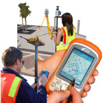
This site is intended to provide you with information on Land Surveying in the Gadsden, AL and Etowah County area of Alabama. If you’re looking for a Gadsden Land Surveyor, you’ve come to the right place. If you’d rather talk to someone about your land surveying needs, please call our local number at (256) 952-4711 today. For more information, please continue to read.
 Land Surveyors are professionals who make precise measurements to determine the size and boundaries of a piece of real estate. While this is a simplistic definition, boundary surveying is one of the most common types of surveying related to home and land owners. If you fall into the following categories, please click on the appropriate link for more information on that subject:
Gadsden Land Surveying services:
-
- I need to know where my property corners or property lines are. (Boundary Survey)
- I have a loan closing or re-finance coming up on my home in a subdivision. (Lot Survey)
- I need a map of my property with contour lines to show elevation differences for my architect or engineer. (Topo Survey)
- I’ve just been told I’m in a flood zone or I’ve been told I need an elevation certificate in order to obtain flood insurance or prove I don’t need it. (Flood Survey)
- I’m purchasing a lot/house in a recorded subdivision. (Lot Survey – See Boundary Survey)
- I’m purchasing a larger tract of land, acreage, that hasn’t been subdivided in the past. (Boundary Survey)
