↓
 

Gadsden Land Surveying

...a local Gadsden Land Surveyor.

Gadsden Land Surveying
  • Home
  • ALTA Survey
  • Boundary Surveying
  • Construction Survey
  • Drone LiDAR Mapping
  • Elevation Certificate
  • Land Surveying
  • Lot Survey – Closing Survey
  • Topographic Survey
  • Etowah County, AL
    • Gadsden, AL
    • Attalla, AL
    • Boaz, AL
    • Glencoe, AL
    • Hokes Bluff, AL
    • Rainbow City, AL
    • Southside, AL
  • Calhoun County, AL
    • Oxford, AL
    • Alexandria, AL
    • Anniston, AL
    • Jacksonville, AL
    • Ohatchee, AL
    • Piedmont, AL
    • Weaver, AL
    • Wellington, AL
  • St. Clair County, AL
    • Ashville, AL
    • Pell City, AL
    • Leeds, AL
    • Moody, AL
    • Odenville, AL
    • Ragland, AL
    • Riverside, AL
    • Steele, AL
    • Trussville, AL
  • Contact Us
Home - Page 2 << 1 2 3 4 5 6 >>

Post navigation

← Older posts
Newer posts →

Surveying For Fence Contruction

Gadsden Land Surveying Posted on November 7, 2019 by Gadsden Land SurveyorApril 2, 2020

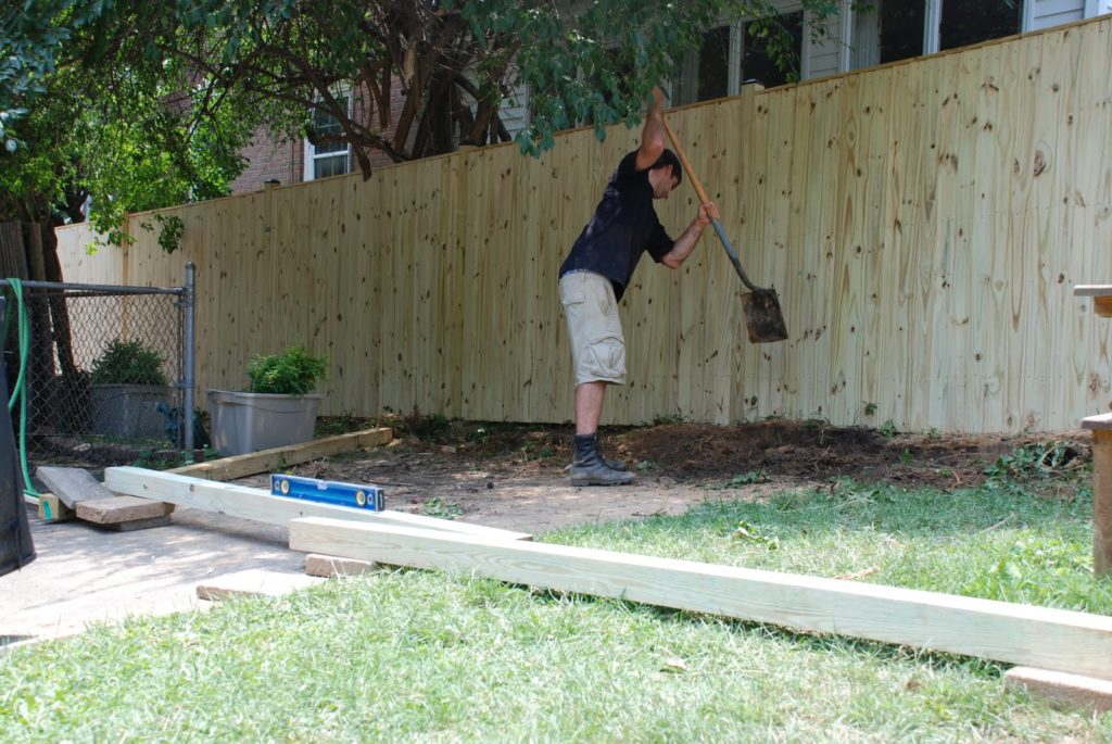
fence construction - fence lineIn a recent article “A lot on the line with a new fence,” the writer mentioned one of the sayings that I always think of regarding fences:

“Good Fences Make Good Neighbors”

Know Where Your Property Line is Located

A large portion of the calls I get are from homeowners wanting to know where their property line is to build a fence, or check whether their neighbor’s fence, or other improvement, is over the line. Knowing where your property lines are on your property is one of the most important things to know when planning for a fence.

While most fence contractors will require you to have a surveyor come out and mark the property lines before they start, some contractors will try to do this themselves. Skipping this step can cost you more than the fence cost. Even though the article writer (no name given) said that “hopefully, you won’t have to hire a surveyor” you should heed my advice on this one, get a surveyor to find and mark your corners.

Fences Usually Cost More Than a Survey

The writer also said that “a full survey could cost more than the fence.” From my experience, a fence can run anywhere from $10/linear foot for chainlink, to $20/linear foot for a wood privacy fence, or higher for more elaborate or ornate fences. Most lot line surveys, for less than an acre lot, will run anywhere from $400 to $600. In my area, I see them normally at about $500 max if the pins are still in. You’d have to have a pretty short cheap fence to cost less than a survey. AND, who wants to move the fence when you find the corners your contractor marked are wrong.

Surveying Cost Savings

If you want to save some money, do the research for the surveyor before you call to get a price. You should get a copy of your deed, scan it to PDF of take a legible photo of it. And, if you live in a subdivision, get a copy of the subdivision plat that is recorded in the Probate Office. Sometimes you can get the Probate office to email this to you. You should send all of your research to the surveyor.

I want to add that a “good fence” is built along the property line. THAT will make good neighbors. Sometimes it has to be 14 feet high, barbed and electric. If you need to know where your property lines are located for a fence or for any reason, call a land surveyor.
To talk about a fence survey for your fence construction job, call Gadsden Land Surveying at (256) 952-4711 today.

Posted in boundary surveying, construction survey, lot survey, property survey | Tagged boundary surveying, construction survey, fence construction, fence survey

Difference in FEMA Elevation Certificate and LOMA

Gadsden Land Surveying Posted on October 6, 2019 by Gadsden Land SurveyorApril 2, 2020

elevation certificate | flood zone | flood surveyI get calls all the time from someone requesting an Elevation Certificate or Elevation Survey. Usually it’s because they’ve gotten a letter in the mail from their mortgage company telling them they have to get flood insurance. This leads them to contact their insurance company and that leads to a surveyor.

“purchasing flood insurance is mandatory…if the loan is federally insured or the lender is regulated by the federal government”

Purpose of the Elevation Certificate

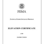
FEMA Elevation CertificateAn Elevation Certificate is a form “…used to provide elevation information necessary to ensure compliance with community floodplain management ordinances, to determine the proper insurance premium rate, and to support a request for a Letter of Map Amendment (LOMA)…” Make sure that your surveyor uses the latest version of this form as it’s currently being revised (March 2016).

Surveyor Measures the Elevations

The surveyor determines the lowest floor elevation of the house, the lowest adjacent grade (LAG) elevations of the house, the elevation of the lowest element attached to the house (like a porch step,) and the lowest elevation of machinery or equipment servicing the building. The surveyor also identifies the building type according to the instructions in the Elevation Certificate form.

Base Flood Elevation Determined

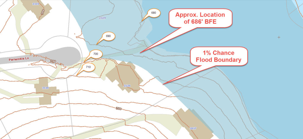
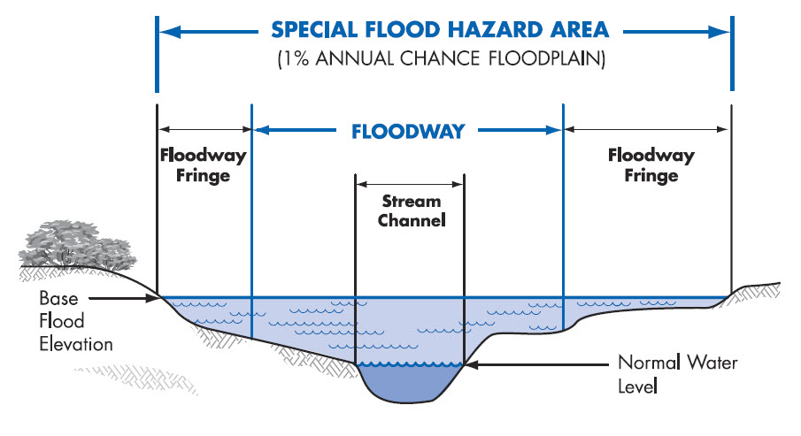
After these are measured, then the Base Flood Elevation (BFE) is determined from either the Flood Maps (FIRM), the Flood Insurance Study (FIS), or by the local community. The difference in elevation between this BFE and the LAG and/or Lowest Floor will determine the insurance premium rate.

LOMA Removes Flood Insurance Requirement

Even if an Elevation Certificate shows that your house is above the Base Flood Elevation at all points, you still have the requirement to obtain flood insurance. Only after the submission and approval of a Letter of Map Amendment (LOMA) can the Flood Map be amended and the Federal mandate for the purchase of flood insurance be removed.GIS with Flood Hazard Zone Overlay

The LOMA process can be done online and typically takes 30 days or less but sometimes a review of the LOMA submission can identify additional information that is needed.

It should be noted that the Elevation Certificate must be completed by a Land Surveyor, Engineer, or an Architect who is authorized by law to certify elevation information, though I don’t know of any Architects that will do these, and not too many Engineers.

Call Gadsden Land Surveying at 256-952-4711 for help with an elevation certificate or LOMA.

Posted in elevation certificate, flood damage, flood survey, LOMA | Tagged elevation certificate, flood survey, flood zone, LOMA

Land Surveying: Why Do You Need One?

Gadsden Land Surveying Posted on August 23, 2019 by Gadsden Land SurveyorApril 2, 2020

Posted in boundary surveying, construction, elevation certificate, land surveying, land surveyor, lot survey, property survey | Tagged land survey gadsden al, land surveying benefits, land surveying gadsden, land surveying importance

Post navigation

← Older posts
Newer posts →

Search This Site

Get Quote Button
© Gadsden Land Surveying by Tucker Engineering, LLC
3331 Rainbow Drive, Suite E, #151
Rainbow City, Alabama 35906
Phone: (256) 952-4711

Web Development and SEO by:
N2Biz.co


Privacy Policy | Terms of Use

↑